
— — Heritage Maps — —
— — Heritage Maps — —
Heirloom Cartography for Cherished Land
Heirloom Cartography for Cherished Land

Van Brocklin Farm LLC
Van Brocklin Farm LLC
Knox County, NE
Knox County, NE
640 Acres
640 Acres
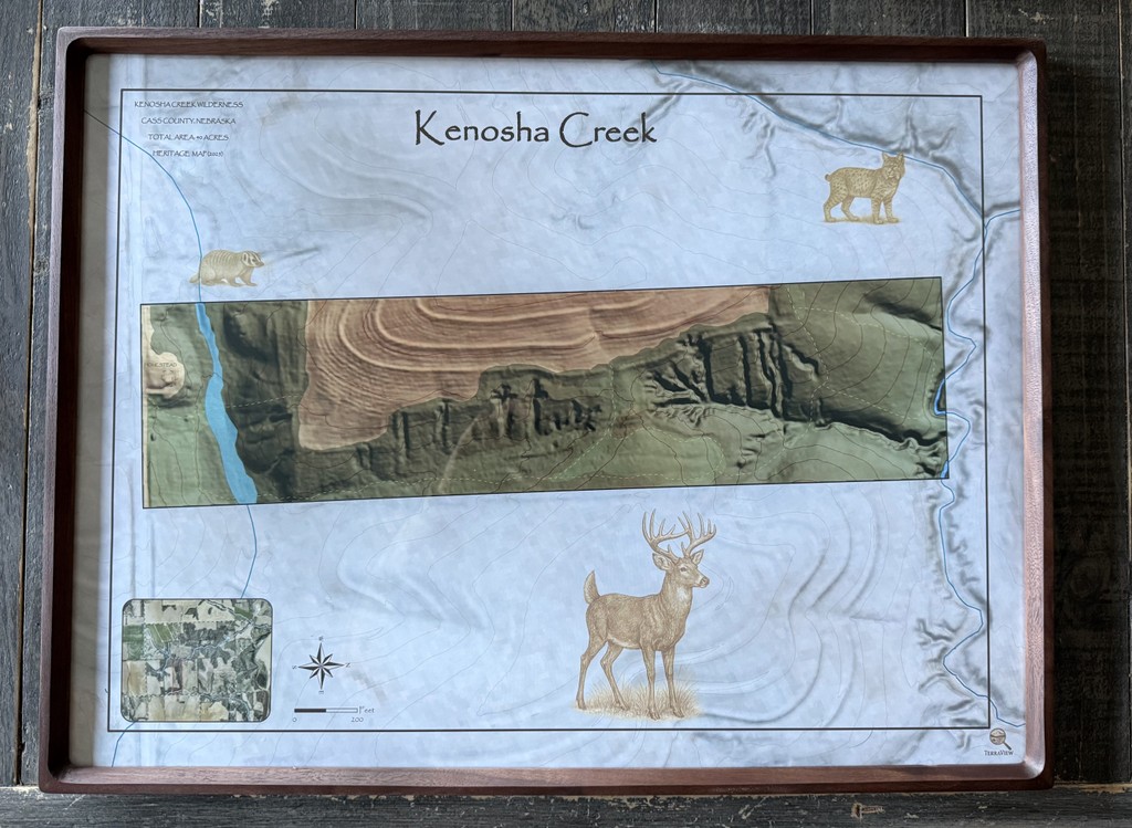
Kenosha Creek
Kenosha Creek
Cass County, NE
Cass County, NE
40 Acres
40 Acres
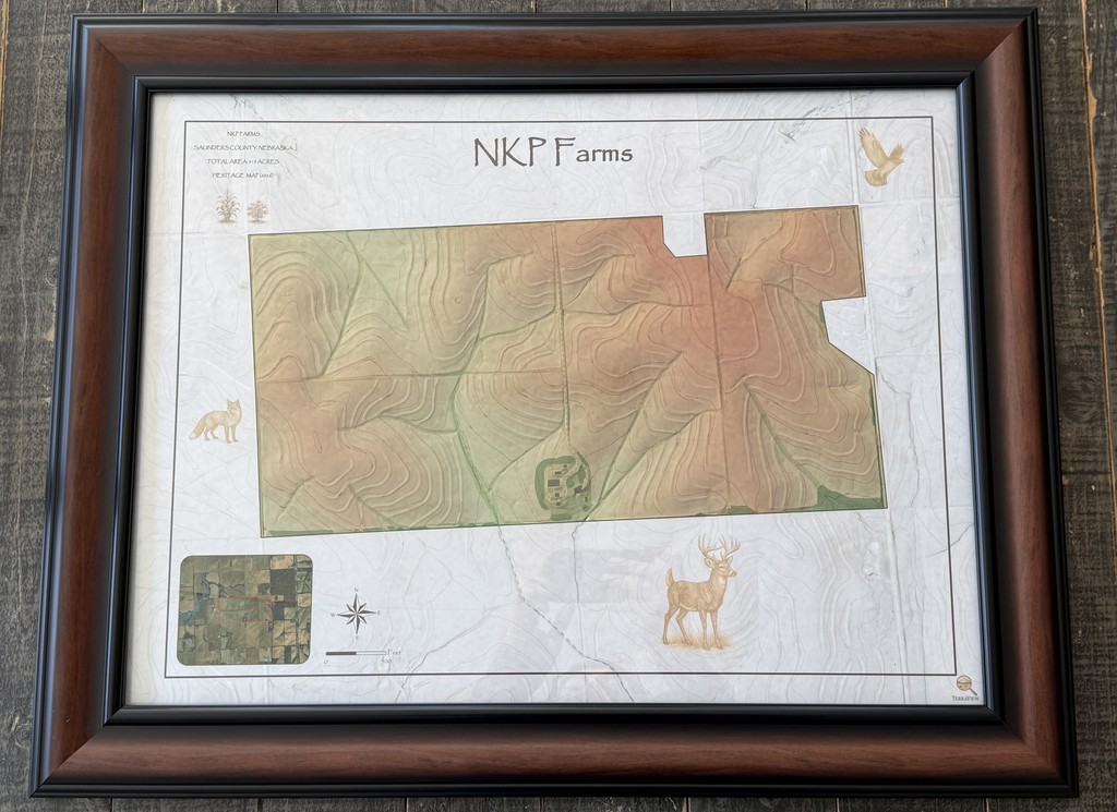
NKP Farms
NKP Farms
Saunders County, NE
Saunders County, NE
325 Acres
325 Acres
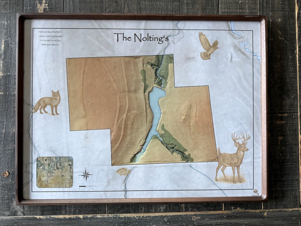
The Nolting's
The Nolting's
Cass County, NE
Cass County, NE
42 Acres
42 Acres
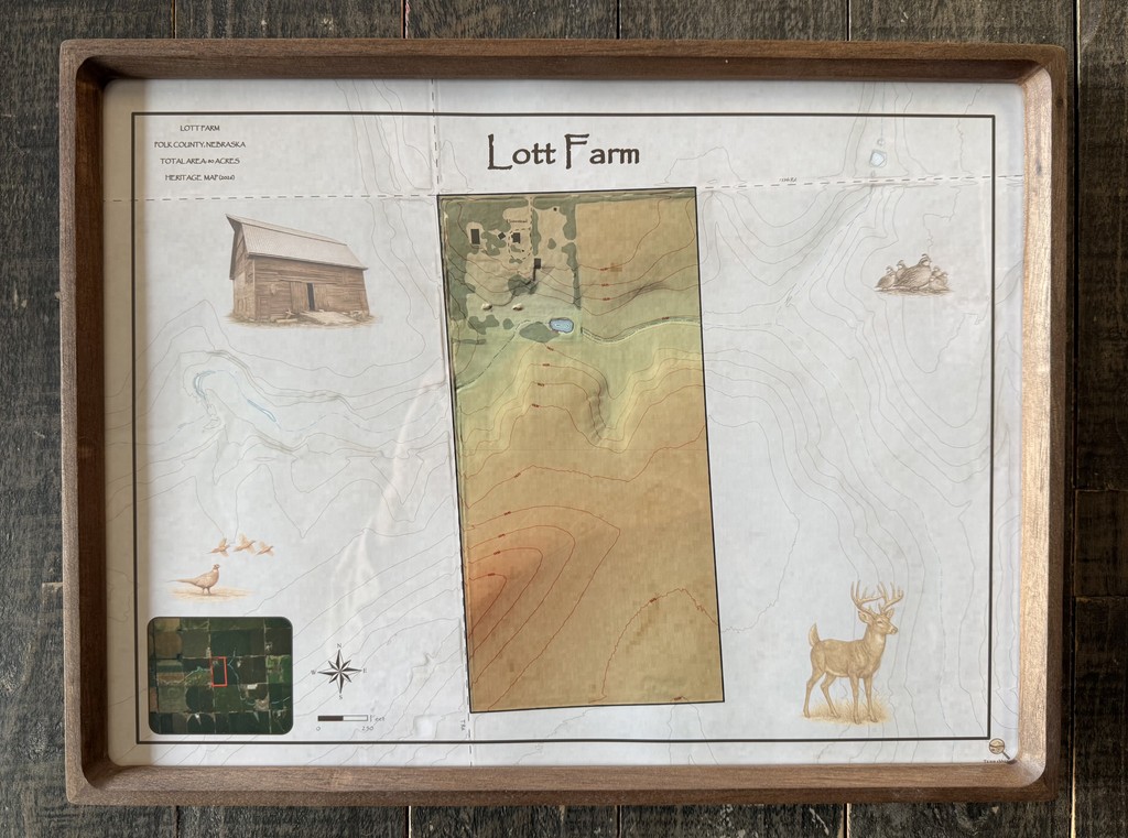
Lott Farm
Lott Farm
Polk County, NE
Polk County, NE
80 Acres
80 Acres
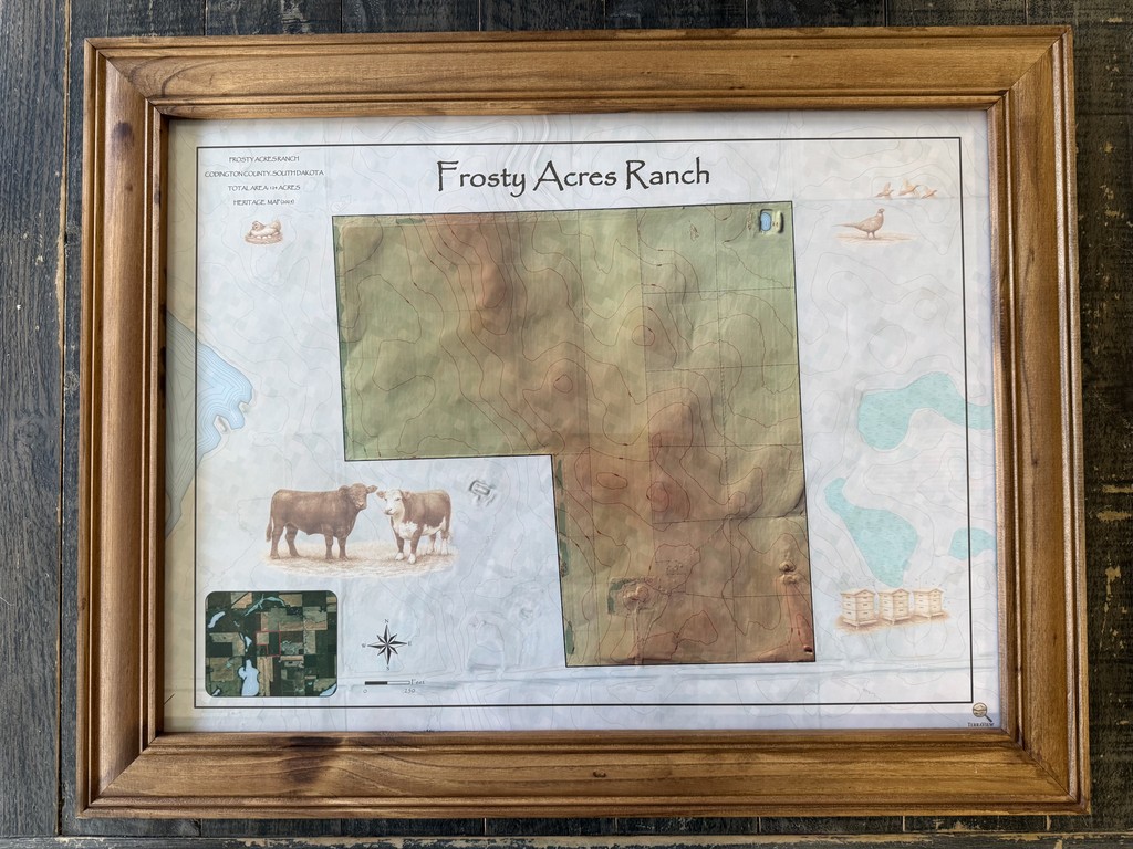
Frosty Acres Ranch
Frosty Acres Ranch
Codington County, SD
Codington County, SD
125 Acres
125 Acres
— — Steward Maps — —
— — Steward Maps — —
Field-Ready. GPS-Enabled. Built to Last
Field-Ready. GPS-Enabled. Built to Last

El Derado
El Derado
Cass County, NE
Cass County, NE
66 Acres
66 Acres

Split Creek Farm
Split Creek Farm
Cass County, NE
Cass County, NE
75 Acres
75 Acres
— — Map Enhancments — —
— — Map Enhancments — —
Add More to Your Map
Add More to Your Map
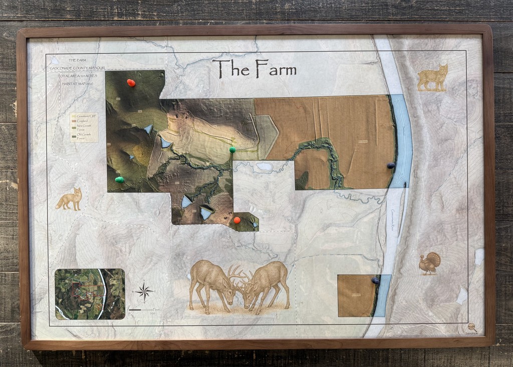
The Farm (Magnetic) - Habitat & Terrain Analysis
The Farm (Magnetic) - Land Summary
Gasconade River Bluffs - MI
Gasconade River Bluffs - MI
325 Acres
325 Acres

Lost Creek Hollow - Field Atlas Edition
Lost Creek Hollow - Field Atlas Edition
Missouri River Bluffs - NE
Missouri River Bluffs - NE
186 Acres
186 Acres
— — Custom Maps — —
— — Custom Maps — —
Custom Maps for Meaningful Places
Custom Maps for Meaningful Places
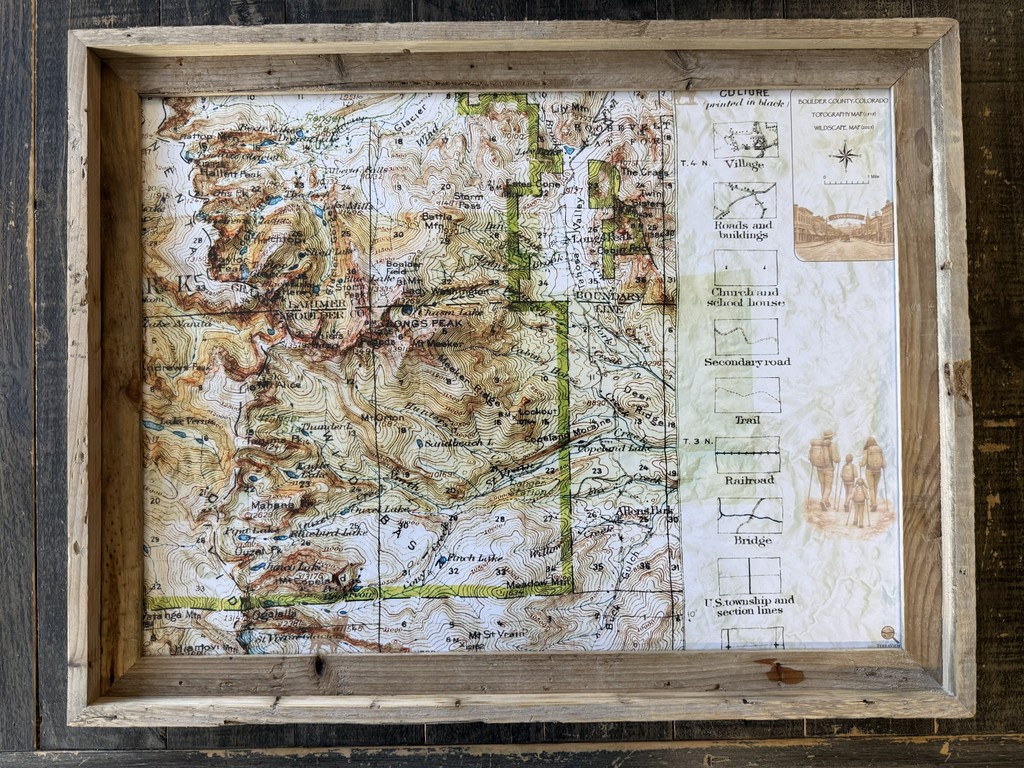
Historic Longs Peak
Historic Longs Peak
Rocky Mountains - CO
Rocky Mountains - CO
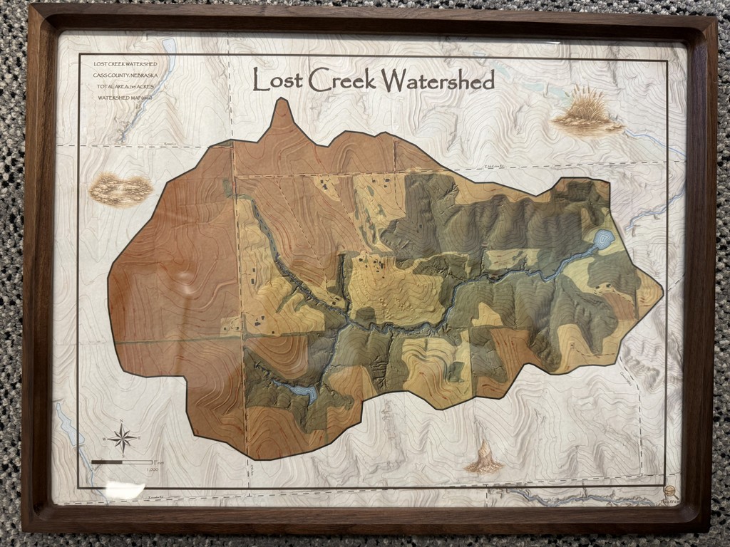
Lost Creek Watershed
Lost Creek Watershed
Missouri River Bluffs - NE
Missouri River Bluffs - NE

Maps Crafted to Capture Land for Generations
2025 TerraView Maps. All Rights Reserved.
sam@terraviewmaps.com


Maps Crafted to Capture Land for Generations
2025 TerraView Maps. All Rights Reserved.
sam@terraviewmaps.com