
— — Map Enhancments — —
— — Map Enhancments — —
Add Clarity, Detail, or Character to Your Map
Add Clarity, Detail, or Character to Your Map
—- Land Summary -—
—- Land Summary -—
Add a deeper layer of insight to your map with the Land Summary Add-On. This map enhancement is available as an add-on for Heritage & Steward Maps, transforming your map into a practical tool for land stewardship, hunting strategy, and long-term property management.
Terrain Feature Labeling - Ridges, Draws, Saddles, Ect..
Habitat Specific Color Pallete - Distinct Colors for Varying Habitat Types.
Habitat Overview - Land Summary Table
Compatible Maps
Compatible Maps
Price
Price
Any Heritage or Steward Map
Any Heritage or Steward Map
+$75
+$75
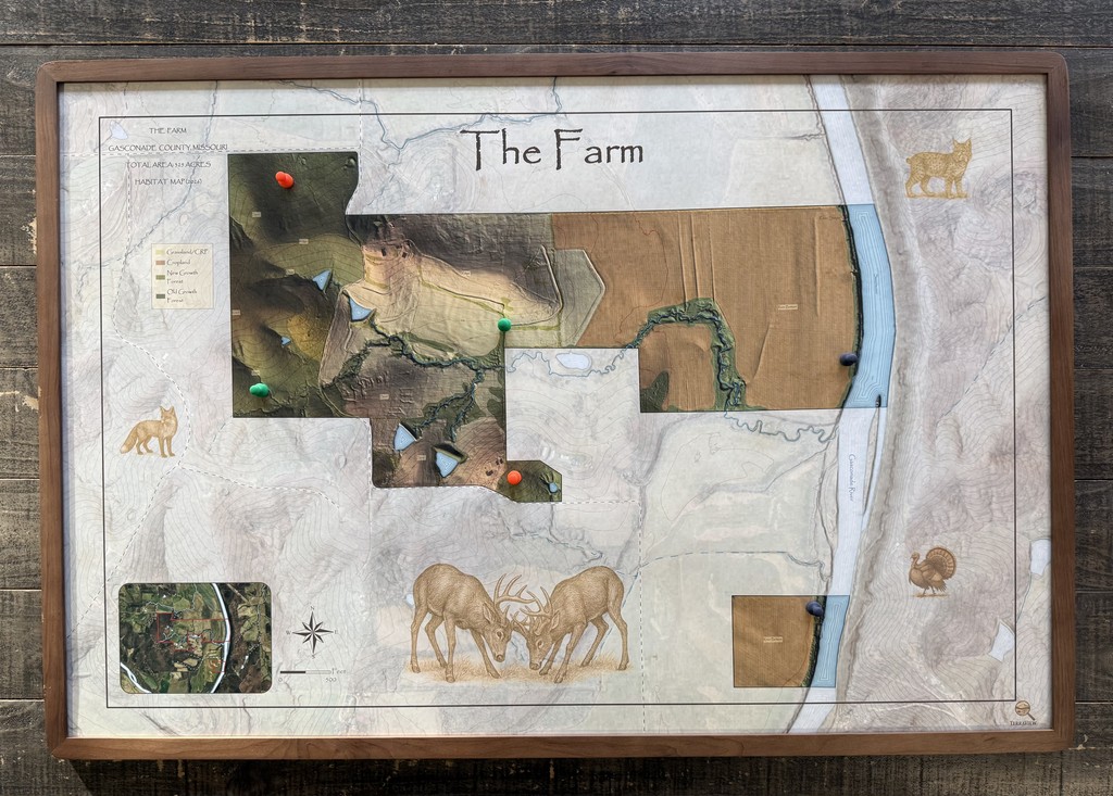
—- Field Atlas Edition -—
—- Field Atlas Edition -—
Add a vintage inspired style to your custom heritage map. This Field Atlas Edition adds a textured, earth tone style to your map that captures attention for generations. This add-on is available for heritage maps only.
Vintage Atlas Inspiration - Timeless Style
Hand-Drawn Inspired Patterns - Textured Overlays Based on Land Cover.
Illustrated Custom Mapping - Artistic Presentation to Your Map
Compatible Maps
Compatible Maps
Price
Price
Any Heritage Map
Any Heritage Map
+$100
+$100


Maps Crafted to Capture Land for Generations
2025 TerraView Maps. All Rights Reserved.
sam@terraviewmaps.com


Maps Crafted to Capture Land for Generations
2025 TerraView Maps. All Rights Reserved.
sam@terraviewmaps.com